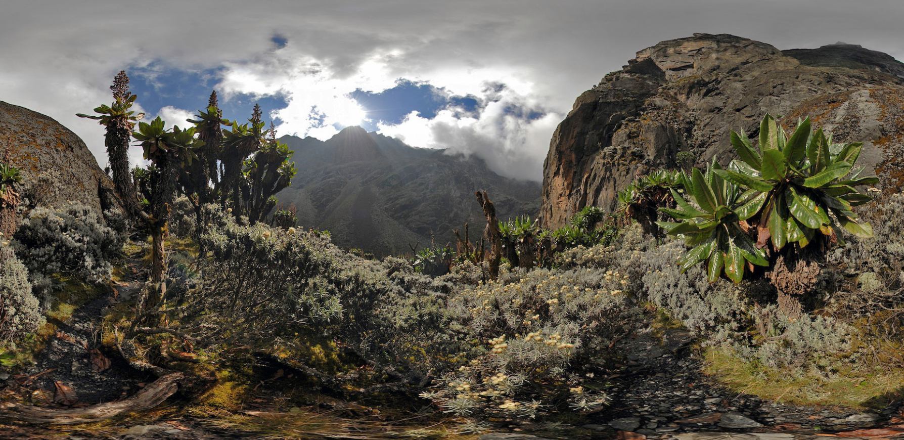
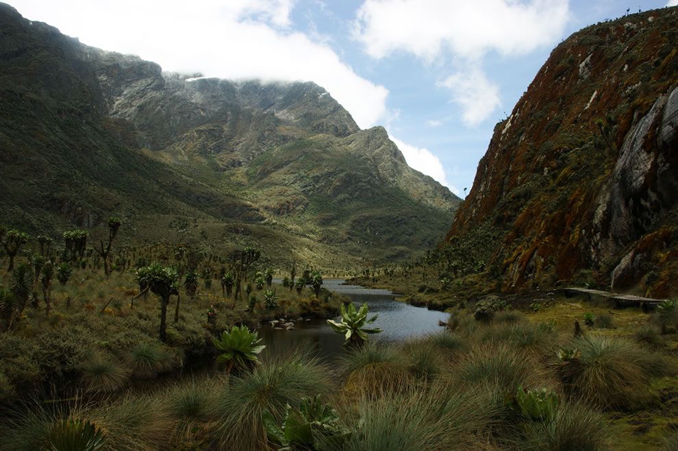
Rwenzori Mountains National Park is a Ugandan national park and UNESCO World Heritage Site located in the Rwenzori Mountains. Almost 1,000 km2 (386 sq mi) in size, the park has Africa's third highest mountain peak and many waterfalls, lakes, and glaciers. The park is known for its beautiful plant life.
Rwenzori Mountains National Park was established in 1991. It was designated a UNESCO World Heritage Site in 1994 because of its outstanding natural beauty. Rebel militias occupied the Rwenzori Mountains from 1997 to June 2001. The park was inscribed on UNESCO's List of World Heritage in Danger between 1999 and 2004 because of insecurity and a lack of resources in the park.
Rwenzori Mountains National Park is located in southwestern Uganda on the east side of the western (Albertine) African rift valley. It lies along Uganda's border with the Democratic Republic of the Congo (DRC) and borders the DRC's Virunga National Park, also a UNESCO World Heritage Site, for 50 km (31 mi). It is situated in the Bundibugyo, Kabarole, and Kasese districts, 25 km (16 mi) from the small town of Kasese. It is 996 km2 (246,117 acres) in size, 70% of which exceeds an altitude of 2,500 m (8,202 ft). The park is 120 km (75 mi) long and 48 km (30 mi) wide.
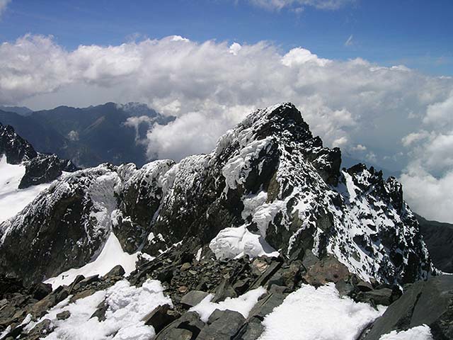
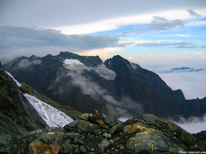
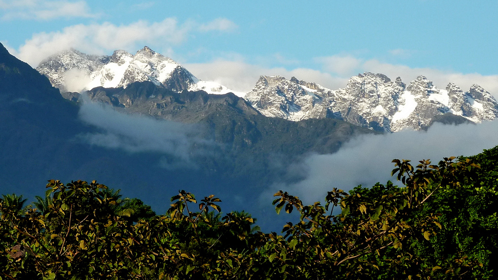
The park comprises most of the centre and eastern half of the Rwenzori Mountains, a mountain range rising above dry plains located just above the equator. The Rwenzori Mountains are higher than the Alps and are ice-capped. Mount Stanley is located in the park. Margherita Peak, one of Mount Stanley's twin summits, is Africa's third highest peak with a height of 5,109 m (16,762 ft). Africa's fourth and fifth highest peaks (Mount Speke and Mount Baker) are also located in the park. The park has glaciers, snowfields, waterfalls, and lakes and is one of Africa's most beautiful mountain areas.